-
Boeing
- Stock Code:
- BA
- Date Founded:
- 1916-07-15
- CEO:
- Dave Calhoun
- Headquarters Location:
- Chicago, USA
- Key Product Lines:
- Boeing 737, Boeing 747, Boeing 757, Boeing 767, Boeing 777, Boeing 787
- Business Type:
- Planemaker

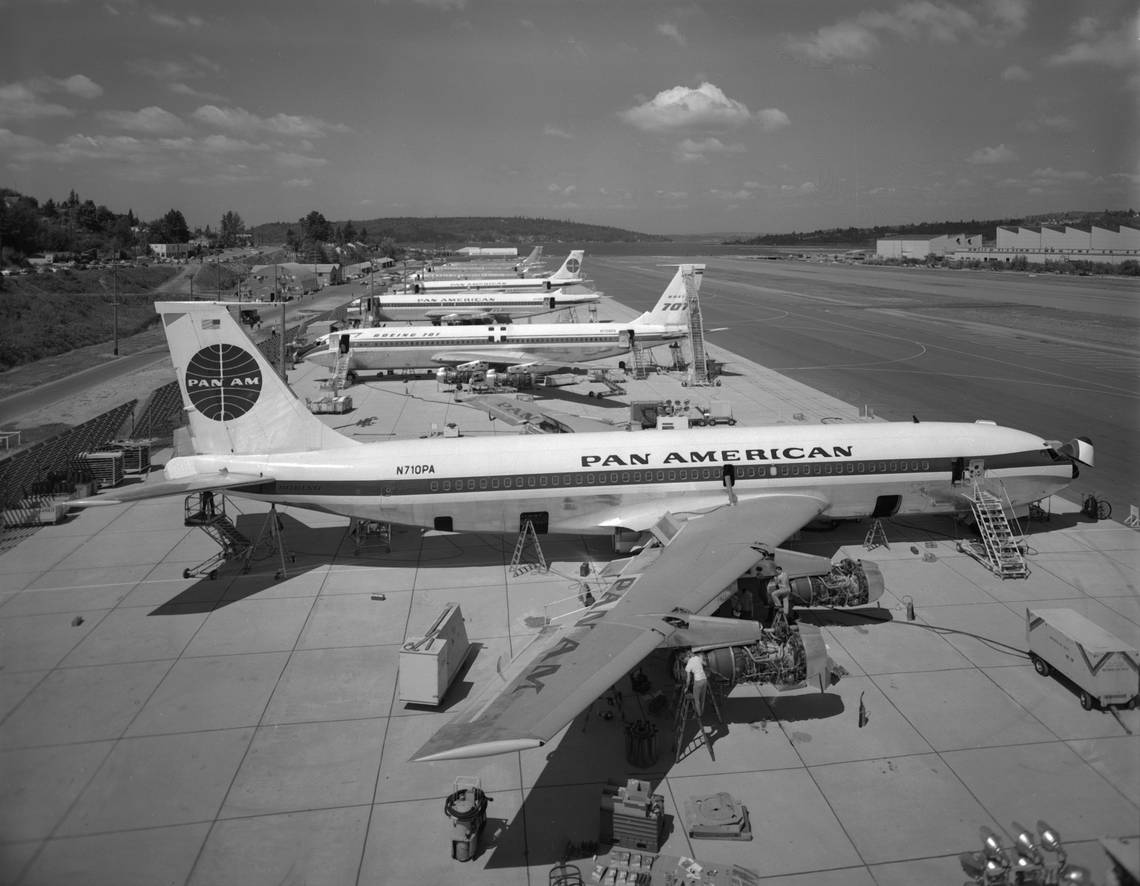
Exactly 57 years ago today, on Friday, September 17, 1965, a Pan American World Airways (Pan AM) Boeing 707 crashed in the British Overseas Territory of Montserrat, killing all 30 passengers and crew. The aircraft, a seven-year-old Boeing 707-100 named "Clipper Constitution" with the registration N708PA, was on a flight from Fort-de-France to Antigua and Barbuda when it crashed into Chances Peak, a 3,002 feet active volcano on the Caribbean island of Montserrat.
.gif?q=50&fit=crop&w=1500&dpr=1.5)
Pan Am Flight 292 was a regularly scheduled flight between Fort-de-France's Le Lamentin Airport (FDF) and New York City, with stops in Antigua (ANU), St. Croix, Virgin Islands (STX), and San Juan, Puerto Rico (SJU).
The crew was aware of thunderstorms in the area
Aware that there was an electrical storm in the vicinity of Antigua, an IFR flight plan had been filed for the short 30-minute flight that would see the Boeing 707 reach a maximum altitude of 16,500 feet.

With the pilot in command, Captain Henderson, in the left seat, the aircraft took off on Runway 27 at 11:04 local time. Air Traffic Control (ATC) clearance had been given for the plane to climb to 16,500 feet. On reaching cruising altitude, it was told to contact Piarco ATC. A transcript of the recordings shows that at 11:09, the plane was flying over the VOR at Pointe-a-Pitre (Guadeloupe), soon after which Picaro ATC cleared the aircraft to descend to 2,500 feet in preparation for landing at Antigua-Coolidge International Airport (ANU).
Stay informed: Sign up for our daily and weekly aviation news digests.
From the air, many of the islands look the same
They were configured for an instrument approach which would have required them to overfly the airport at 2,500 feet because of the terrain. The controller in charge of the flight landing in St. John's provided the pilots with all the relevant weather information and told them they were clear to land on Runway 07. At 11:25, the controller in St. Johns asked flight 292 if they had the airport in sight, to which the reply from the pilots was negative. He then instructed the plane to continue the approach and contact him when they could see the airport.
One of the problems facing pilots if they are not familiar with the eastern Caribbean Sea is that many of the islands look the same from the air. On the route from Fort-de-France, they would have seen the coastlines of Dominica, Marie Galante, Guadeloupe, Montserrat, and Antigua.

Several witnesses on the southwest coast of Montserrat reported seeing the plane flying below the clouds with its landing gear down. Using radio masts as a guide, they estimated that the aircraft was flying at an altitude of just over 1,000 feet above the ground. Not long after losing sight of the plane, the witnesses describe hearing an explosion which they assumed was the plane crashing into Chance Mountain. The aircraft's wreckage was found in dense jungle 242 feet below the mountain's summit. None of the 21 passengers and nine crew had survived.
Pilot error was to blame for the crash
According to a later investigation, the cause of the accident was put down to pilot error. The crew was unsure of their location and had descended to an unsafe height.